
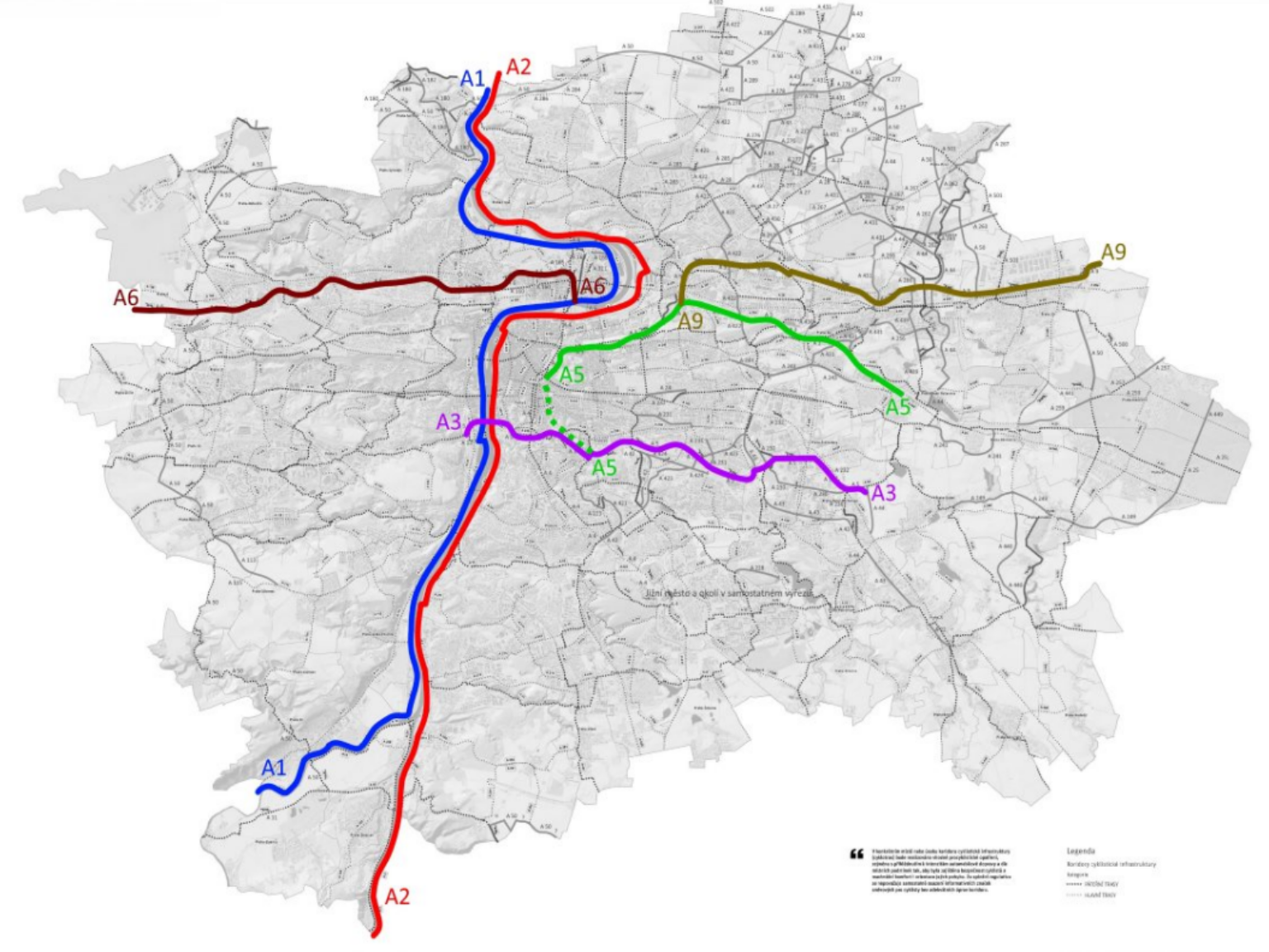
A continuation of the series on cycling infrastructure in Prague. Its development has been frustrating, marked by stories full of countless twists and turns. In this series, I would like to share what I remember from almost twenty years of involvement—before I forget it completely.
This installment kicks off the story of routes that are nowhere near as complete as the Vltava-side A1 and A2. It is therefore necessary to explain where the A3 and other routes actually came from in the citywide system—they are, after all, much younger than their Vltava-adjacent sisters.
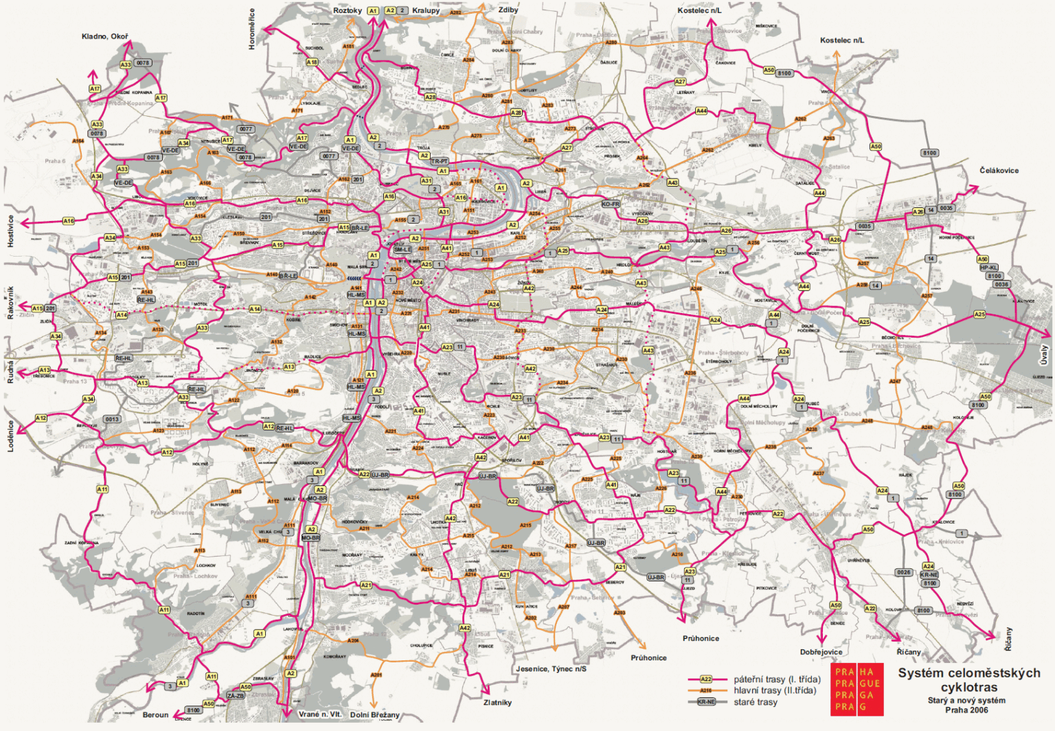
Before the citywide cycle route system existed, Prague had a few long-distance routes and local connectors marked by neighborhood acronyms (e.g., SM-LE, ÚJ-BR). Routes were routed wherever „feasible“ and were strictly intended for recreational use. Typical alignments followed stream valleys without much regard for the transportation needs of Prague residents. This setup was wholly inadequate for the intensive infrastructure development launched under Mayor Pavel Bém (ODS) after 2003. The system was subsequently revamped into the „A-numbered“ framework still used in Prague today.
The original 2006 version of the citywide system drew heavy inspiration from its predecessor but was built around a clear grid logic:
The system assumed arterial routes would be separated from motor traffic to a greater extent than main routes. For instance, route A23 along the Botič stream was paralleled by route A230 along Vršovická Street. The network was updated roughly every two years. While the earliest versions meandered to avoid main streets, the alignments gradually became more transport-focused. By 2011, the system confidently routed A41 directly along 5. května Street.
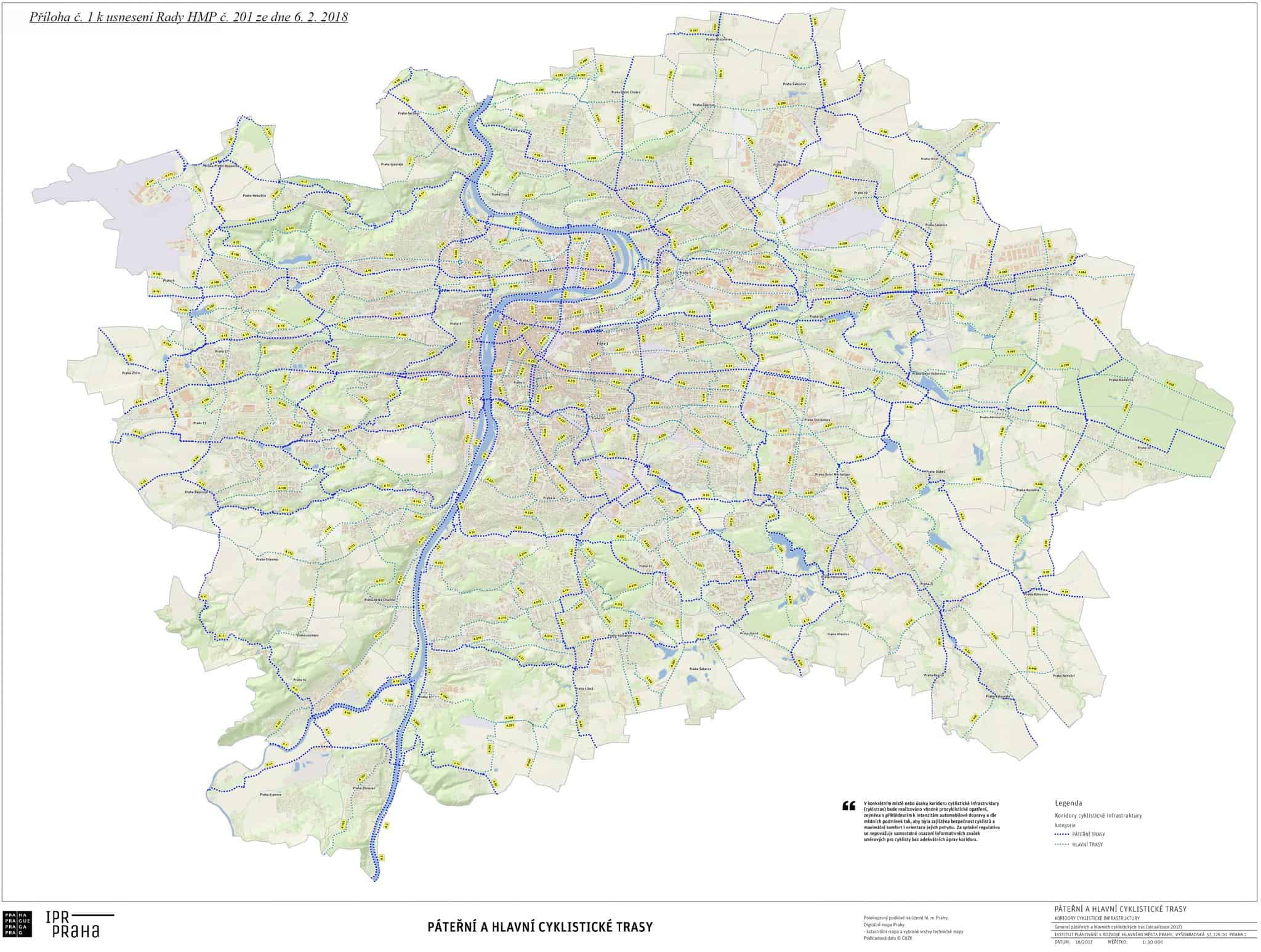
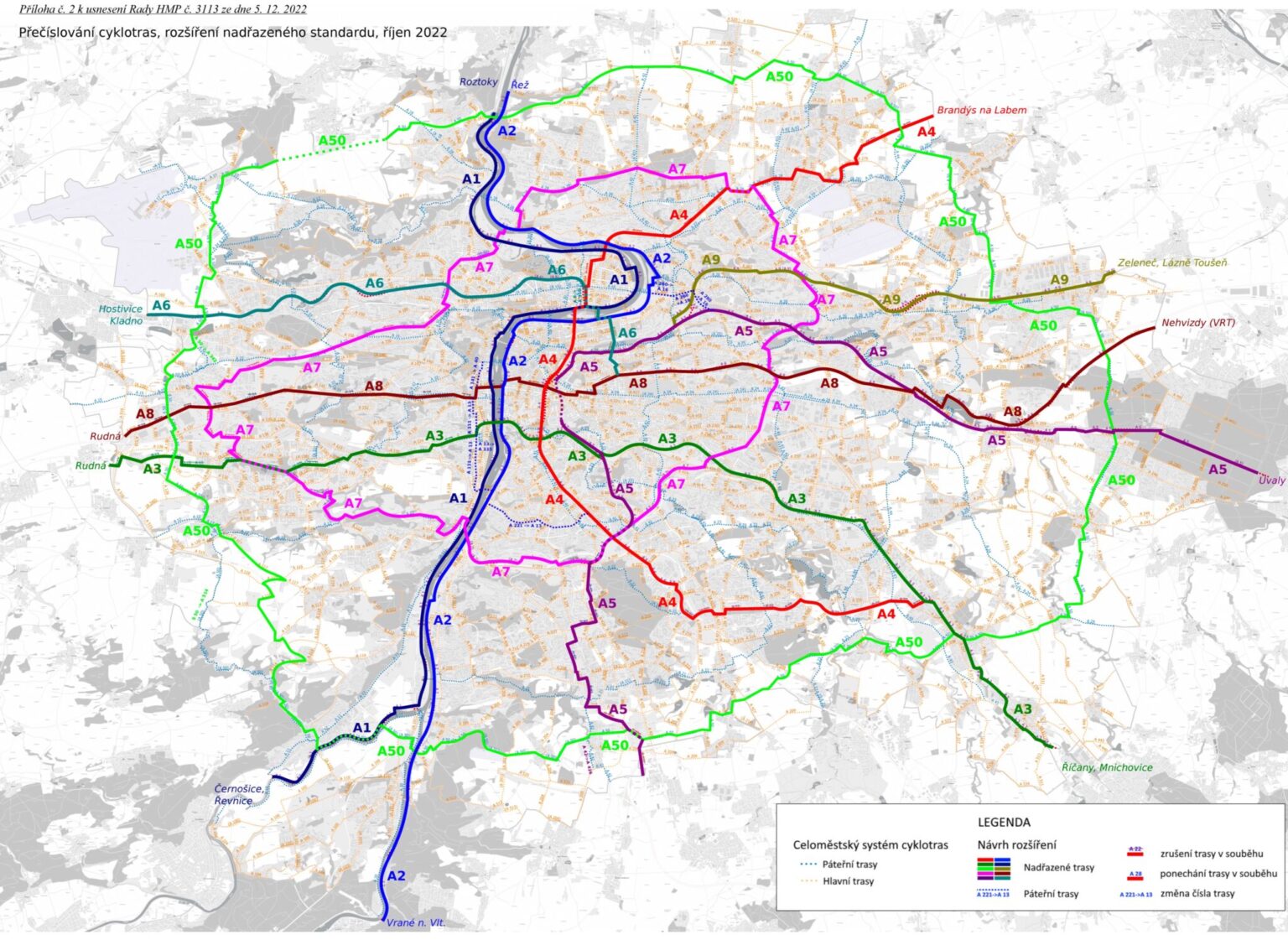
By 2012, the system had stabilized for several years—largely because support for cycling infrastructure as a whole froze. Major revisions resumed after 2016 to increase network density. Changes were driven by requests from municipal districts and spatial development studies; for example, a route was added along the proposed Vršovice railway promenade corridor. However, the biggest shift came in early 2019 with the creation of an entirely new tier: primary routes (nadřazené trasy).
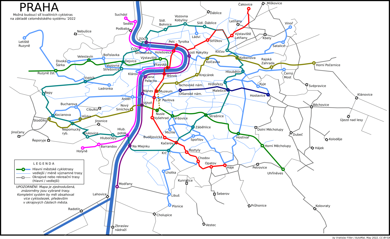
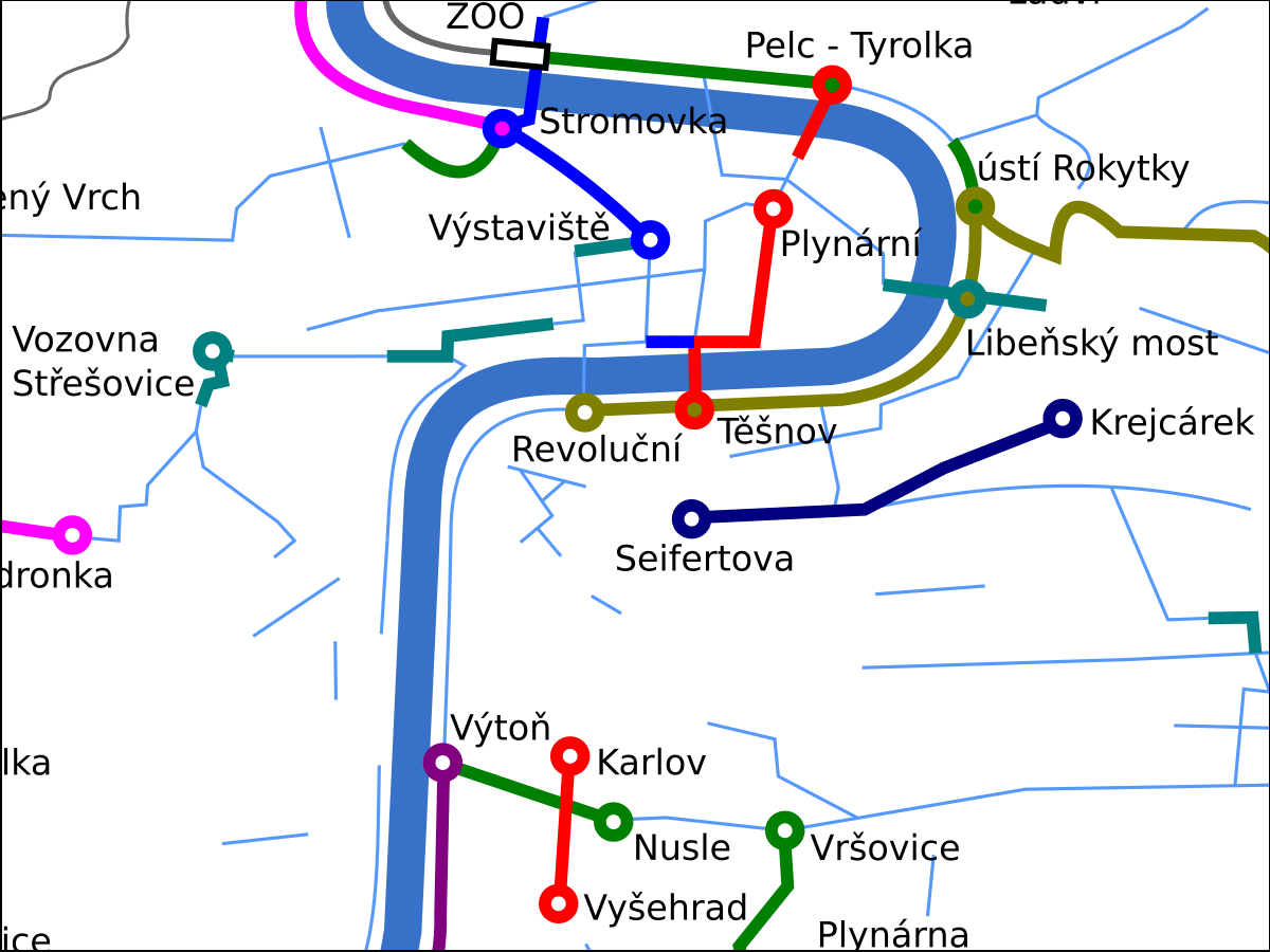
The idea for a new class of routes serving major traffic corridors—offering high comfort, efficiency, and the marketing value of easily recognizable single-digit „lines“—had many fathers. It was inspired by London’s Cycle Superhighways, as well as my own 2015 vision of „Prague Metro-Paths“ (metrostezky), which aimed to give cyclists a legible transit system mirroring the Prague Metro network.
Following the collapse of the TSK (Technical Administration of Roadways) task-card system—which had governed the implementation of individual investments for a decade—the City Authority felt the lack of clear standards for different route categories. Meanwhile, the distinction between arterial and main routes was blurring in practice: outer borough projects built comfortable off-road cycle paths along main routes, while central arterial routes were relegated to shared traffic corridors.
Additionally, several railway path studies crystallized plans for a cycle express path from Balabenka to Horní Počernice and the Vršovice Railway Promenade—projects that the general plan either ignored entirely or covered only with lower-tier routes.
The Cycling Commission’s 2017 recommendations for arterial route standards were a first attempt to define higher specifications for protected routes. However, this effort ran into existing organizational chaos; the rigid routing of legacy arterials could not accommodate standards that guaranteed fully protected infrastructure for newly defined railway corridors. The citywide system urgently needed a fresh approach to both quality standards and route alignments.
The main driving force behind the proposal for „marketing-friendly cycle routes“ A1 through A10 was Marek Bělor, my former colleague at AutoMat who later served as an advisor to Prague Deputy Mayors for Transport (Adam Scheinherr, Zdeněk Hřib, and Jaromír Beránek). His initial draft dates back to an August 2015 email.
In 2017, an expert team incorporated these new single-digit routes into the citywide system. In the initial version approved by the Prague City Council in February 2019, the new routes were:
(Note: These route names were informal designations proposed retroactively.)
Routes A4 (North-South Express Route), A7 (City Ring), and A8 (Žižkov Radial) were formally added to the system later, though their alignments had been envisioned—and their numbers reserved—as early as 2018.
Key subsequent additions in the inner city included connecting Route A6 via the HolKa footbridge and the Žižkov Tunnel to Route A8 at Olšanské náměstí, as well as extending Route A8 from Olšanské náměstí through Náměstí Míru to Anděl.
Primary routes were also generally extended all the way to the Prague city border, though their central segments were always considered the highest priority. Upgrading segments of A13 and A14 in Motol was largely seen as a formality. The final structural update in 2023 elevated the ring route A50 to primary status as A0.
The Active Mobility Standards approved in 2022 formally account for primary routes, mandating wider paths and stricter separation from pedestrians and motor vehicles than required for arterial routes. Together with these standards, route classifications specify exactly what type of infrastructure should be built along any given segment. In April 2026, the Cycling Commission reaffirmed this interpretation, emphasizing protected design measures wherever feasible.
The next installment in this series will cover how the rollout of primary cycle routes began under Deputy Mayor for Transport Adam Scheinherr, and how it was subsequently largely sidelined during the current electoral term.
This is an adjusted machine translation using Gemini of this article: https://mestemnakole.cz/2026/08/vzpominani-na-prazske-cyklotrasy-10-kde-se-vzaly-nadrazene-trasy/
Líbil se Vám článek? Chcete v Česku lepší podmínky pro cyklodopravu?
Podpořte nás, stačí i 100 korun. 💙🚲
Vyberte prosím částku, poté budete přesmerováni na darujme.cz





komentář